Curiosity Finds Active And Ancient Organic Chemistry On Mars
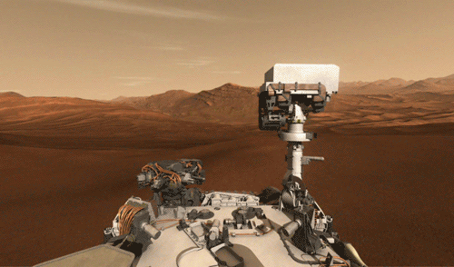
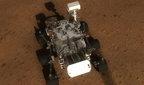
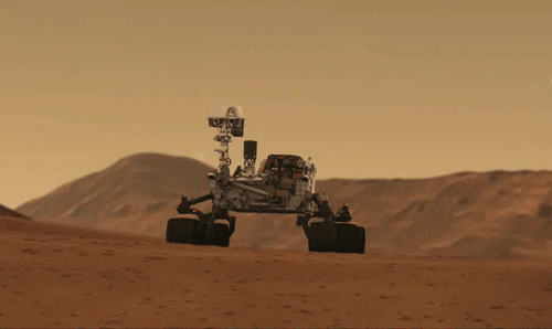
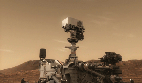
Curiosity Finds Active and Ancient Organic Chemistry on Mars
NASA’s Mars Curiosity rover has measured a tenfold spike in methane, an organic chemical, in the atmosphere around it and detected other organic molecules in a rock-powder sample collected by the robotic laboratory’s drill.
Researchers used Curiosity’s onboard Sample Analysis at Mars (SAM) laboratory a dozen times in a 20-month period to sniff methane in the atmosphere. During two of those months, in late 2013 and early 2014, four measurements averaged seven parts per billion. Before and after that, readings averaged only one-tenth that level.
Curiosity also detected different Martian organic chemicals in powder drilled from a rock dubbed Cumberland, the first definitive detection of organics in surface materials of Mars. These Martian organics could either have formed on Mars or been delivered to Mars by meteorites.
Organic molecules, which contain carbon and usually hydrogen, are chemical building blocks of life, although they can exist without the presence of life. Curiosity’s findings from analyzing samples of atmosphere and rock powder do not reveal whether Mars has ever harbored living microbes, but the findings do shed light on a chemically active modern Mars and on favorable conditions for life on ancient Mars.
For more information:
Mars methane detection and variability at Gale crater
Habitability, Taphonomy, and the Search for Organic Carbon on Mars
Recent Findings from NASA’s Curiosity Rover about Modern and Ancient Mars
Credit: NASA/JPL-Caltech/MSSS
More Posts from Jpl-official-blog and Others

Nic Cage Rover analyzing a rock


Mars Rover Views Spectacular Layered Rock Formations
The layered geologic past of Mars is revealed in stunning detail in new color images returned by NASA’s Curiosity Mars rover, which is currently exploring the “Murray Buttes” region of lower Mount Sharp.
The new images arguably rival photos taken in U.S. National Parks. Curiosity took the images with its Mast Camera (Mastcam) on Sept. 8.
The rover team plans to assemble several large, color mosaics from the multitude of images taken at this location in the near future.
“Curiosity’s science team has been just thrilled to go on this road trip through a bit of the American desert Southwest on Mars,” said Curiosity Project Scientist Ashwin Vasavada, of NASA’s Jet Propulsion Laboratory, Pasadena, California.
The Martian buttes and mesas rising above the surface are eroded remnants of ancient sandstone that originated when winds deposited sand after lower Mount Sharp had formed.
“Studying these buttes up close has given us a better understanding of ancient sand dunes that formed and were buried, chemically changed by groundwater, exhumed and eroded to form the landscape that we see today,” Vasavada said.
The new images represent Curiosity’s last stop in the Murray Buttes, where the rover has been driving for just over one month. As of this week, Curiosity has exited these buttes toward the south, driving up to the base of the final butte on its way out. In this location, the rover began its latest drilling campaign (on Sept. 9). After this drilling is completed, Curiosity will continue farther south and higher up Mount Sharp, leaving behind these spectacular formations.
Curiosity landed near Mount Sharp in 2012. It reached the base of the mountain in 2014 after successfully finding evidence on the surrounding plains that ancient Martian lakes offered conditions that would have been favorable for microbes if Mars has ever hosted life. Rock layers forming the base of Mount Sharp accumulated as sediment within ancient lakes billions of years ago.
On Mount Sharp, Curiosity is investigating how and when the habitable ancient conditions known from the mission’s earlier findings evolved into conditions drier and less favorable for life.
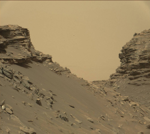
IMAGE 1….This view from the Mast Camera (Mastcam) in NASA’s Curiosity Mars rover shows an outcrop with finely layered rocks within the “Murray Buttes” region on lower Mount Sharp. The buttes and mesas rising above the surface in this area are eroded remnants of ancient sandstone that originated when winds deposited sand after lower Mount Sharp had formed. Curiosity closely examined that layer – called the “Stimson formation” – during the first half of 2016, while crossing a feature called “Naukluft Plateau” between two exposures of the Murray formation. The layering within the sandstone is called “cross-bedding” and indicates that the sandstone was deposited by wind as migrating sand dunes. The image was taken on Sept. 8, 2016, during the 1454th Martian day, or sol, of Curiosity’s work on Mars.
IMAGE 2….This view from the Mast Camera (Mastcam) in NASA’s Curiosity Mars rover shows a sloping hillside within the “Murray Buttes” region on lower Mount Sharp. The rim of Gale Crater, where the rover has been active since landing in 2012, is visible in the distance, through the dusty haze. The image was taken on Sept. 8, 2016, during the 1454th Martian day, or sol, of Curiosity’s work on Mars.
IMAGE 3….This view from the Mast Camera (Mastcam) in NASA’s Curiosity Mars rover shows sloping buttes and layered outcrops within the “Murray Buttes” region on lower Mount Sharp. The buttes and mesas rising above the surface are eroded remnants of ancient sandstone that originated when winds deposited sand after lower Mount Sharp had formed. Curiosity closely examined that layer – called the “Stimson formation” – during the first half of 2016, while crossing a feature called “Naukluft Plateau” between two exposures of the Murray formation. The layering within the sandstone is called “cross-bedding” and indicates that the sandstone was deposited by wind as migrating sand dunes. The image was taken on Sept. 8, 2016, during the 1454th Martian day, or sol, of Curiosity’s work on Mars.
IMAGE 4….This view from the Mast Camera (Mastcam) in NASA’s Curiosity Mars rover shows finely layered rocks within the “Murray Buttes” region on lower Mount Sharp. The buttes and mesas rising above the surface in this area are eroded remnants of ancient sandstone that originated when winds deposited sand after lower Mount Sharp had formed. Curiosity closely examined that layer – called the “Stimson formation” – during the first half of 2016, while crossing a feature called “Naukluft Plateau” between two exposures of the Murray formation. The layering within the sandstone is called “cross-bedding” and indicates that the sandstone was deposited by wind as migrating sand dunes. The image was taken on Sept. 8, 2016, during the 1454th Martian day, or sol, of Curiosity’s work on Mars.
IMAGE 5….This view from the Mast Camera (Mastcam) in NASA’s Curiosity Mars rover shows a hillside outcrop with layered rocks within the “Murray Buttes” region on lower Mount Sharp. The buttes and mesas rising above the surface in this area are eroded remnants of ancient sandstone that originated when winds deposited sand after lower Mount Sharp had formed. Curiosity closely examined that layer – called the “Stimson formation” – during the first half of 2016, while crossing a feature called “Naukluft Plateau” between two exposures of the Murray formation. The layering within the sandstone is called “cross-bedding” and indicates that the sandstone was deposited by wind as migrating sand dunes. The image was taken on Sept. 8, 2016, during the 1454th Martian day, or sol, of Curiosity’s work on Mars. Malin Space Science Systems, San Diego, built and operates the rover’s Mastcam. NASA’s Jet Propulsion Laboratory, a division of Caltech in Pasadena, manages the Mars Science Laboratory Project for NASA’s Science Mission Directorate, Washington. JPL designed and built the project’s Curiosity rover.

Donkey was always my favorite from Shrek
NASA Climate Modeling Suggests Venus May Have Been Habitable
NASA logo. Aug. 11, 2016 Venus may have had a shallow liquid-water ocean and habitable surface temperatures for up to 2 billion years of its early history, according to computer modeling of the planet’s ancient climate by scientists at NASA’s Goddard Institute for Space Studies (GISS) in New York. The findings, published this week in the journal Geophysical Research Letters, were obtained with a model similar to the type used to predict future climate change on Earth. “Many of the same tools we use to model climate change on Earth can be adapted to study climates on other planets, both past and present,” said Michael Way, a researcher at GISS and the paper’s lead author. “These results show ancient Venus may have been a very different place than it is today.” Venus today is a hellish world. It has a crushing carbon dioxide atmosphere 90 times as thick as Earth’s. There is almost no water vapor. Temperatures reach 864 degrees Fahrenheit (462 degrees Celsius) at its surface.
Image above: Observations suggest Venus may have had water oceans in its distant past. A land-ocean pattern like that above was used in a climate model to show how storm clouds could have shielded ancient Venus from strong sunlight and made the planet habitable. Image Credit: NASA. Scientists long have theorized that Venus formed out of ingredients similar to Earth’s, but followed a different evolutionary path. Measurements by NASA’s Pioneer mission to Venus in the 1980s first suggested Venus originally may have had an ocean. However, Venus is closer to the sun than Earth and receives far more sunlight. As a result, the planet’s early ocean evaporated, water-vapor molecules were broken apart by ultraviolet radiation, and hydrogen escaped to space. With no water left on the surface, carbon dioxide built up in the atmosphere, leading to a so-called runaway greenhouse effect that created present conditions. Previous studies have shown that how fast a planet spins on its axis affects whether it has a habitable climate. A day on Venus is 117 Earth days. Until recently, it was assumed that a thick atmosphere like that of modern Venus was required for the planet to have today’s slow rotation rate. However, newer research has shown that a thin atmosphere like that of modern Earth could have produced the same result. That means an ancient Venus with an Earth-like atmosphere could have had the same rotation rate it has today. Another factor that impacts a planet’s climate is topography. The GISS team postulated ancient Venus had more dry land overall than Earth, especially in the tropics. That limits the amount of water evaporated from the oceans and, as a result, the greenhouse effect by water vapor. This type of surface appears ideal for making a planet habitable; there seems to have been enough water to support abundant life, with sufficient land to reduce the planet’s sensitivity to changes from incoming sunlight. Way and his GISS colleagues simulated conditions of a hypothetical early Venus with an atmosphere similar to Earth’s, a day as long as Venus’ current day, and a shallow ocean consistent with early data from the Pioneer spacecraft. The researchers added information about Venus’ topography from radar measurements taken by NASA’s Magellan mission in the 1990s, and filled the lowlands with water, leaving the highlands exposed as Venusian continents. The study also factored in an ancient sun that was up to 30 percent dimmer. Even so, ancient Venus still received about 40 percent more sunlight than Earth does today. “In the GISS model’s simulation, Venus’ slow spin exposes its dayside to the sun for almost two months at a time,” co-author and fellow GISS scientist Anthony Del Genio said. “This warms the surface and produces rain that creates a thick layer of clouds, which acts like an umbrella to shield the surface from much of the solar heating. The result is mean climate temperatures that are actually a few degrees cooler than Earth’s today.” The research was done as part of NASA’s Planetary Science Astrobiology program through the Nexus for Exoplanet System Science (NExSS) program, which seeks to accelerate the search for life on planets orbiting other stars, or exoplanets, by combining insights from the fields of astrophysics, planetary science, heliophysics, and Earth science. The findings have direct implications for future NASA missions, such as the Transiting Exoplanet Survey Satellite and James Webb Space Telescope, which will try to detect possible habitable planets and characterize their atmospheres. Related Links Read the paper in Geophysical Research Letters: http://www.onlinelibrary.wiley.com/doi/10.1002/2016GL069790/abstract NASA GISS’ NExSS activities: http://www.giss.nasa.gov/projects/astrobio/ NASA GISS website: http://www.giss.nasa.gov/ Image (mentioned), Text, Credits: NASA’s Goddard Institute for Space Studies, by Michael Cabbage and Leslie McCarthy/Rob Garner. Greetings, Orbiter.ch Full article

Nasa’s Curiosity rover finds water in Martian soil
Dirt sample reveals two pints of liquid water per cubic feet, not freely accessible but bound to other minerals in the soil.
Water has been discovered in the fine-grained soil on the surface of Mars, which could be a useful resource for future human missions to the red planet, according to measurements made by Nasa’s Curiosity rover.
Each cubic foot of Martian soil contains around two pints of liquid water, though the molecules are not freely accessible, but rather bound to other minerals in the soil.
The Curiosity rover has been on Mars since August 2012, landing in an area near the equator of the planet known as Gale Crater. Its target is to circle and climb Mount Sharp, which lies at the centre of the crater, a five-kilometre-high mountain of layered rock that will help scientists unravel the history of the planet.
Full Article
Credit: NASA / Alok Jha


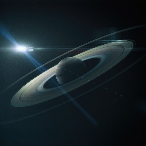
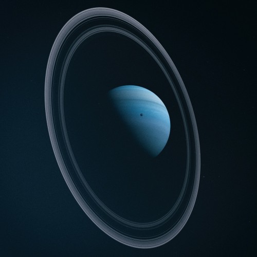
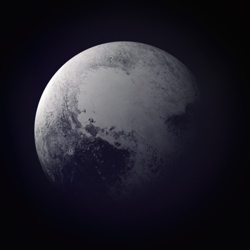
Planet Series - Beau Wright

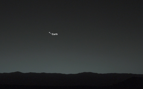
Earth, you are my wishing star. Here’s how you look from my home on the surface of Mars.
Yeah but actually do it tho…
Reblog this if its okay for your followers to introduce themselves to you.
Just come to my ask box and tell me stuff about yourself. Your pets. Your favorite music. What you had for breakfast this morning. Literally anything you want, I love making new friends
Ahh, scientists. Impatient, but the best


Fifty years ago, a bunch of impatient scientists didn’t want to wait all day for a computer to compute the very first digital photo of Mars, so they colored the printout with pastels and made the print themselves.
-
 rowdyravenclaw reblogged this · 6 years ago
 -
 fooshykitty liked this · 6 years ago
 -
 shann-the-artist-moon reblogged this · 6 years ago
 -
shann-the-artist-moon liked this · 6 years ago
-
 sofiavasquez15 reblogged this · 6 years ago
 -
 thestoryofone liked this · 6 years ago
 -
 neutral-reading liked this · 6 years ago
 -
 ajc18615425 liked this · 6 years ago
 -
 magnificentfreek liked this · 6 years ago
 -
 thememeingdead reblogged this · 6 years ago
 -
 thunderingbats liked this · 6 years ago
 -
 zinadupree liked this · 6 years ago
 -
 rossacorsa liked this · 6 years ago
 -
 lucillaenchantress liked this · 6 years ago
 -
wojack55 liked this · 6 years ago
-
 calamity-queen liked this · 6 years ago
 -
 zeddlocket liked this · 6 years ago
 -
 corna-void liked this · 6 years ago
 -
 midnight-weblum-hunting liked this · 6 years ago
 -
 sophiajosephe liked this · 6 years ago
 -
 maniakmonkey liked this · 6 years ago
 -
 jester-toon-rabbit liked this · 6 years ago
 -
 aro-ace-from-outer-space22 reblogged this · 6 years ago
 -
 rhymeswithpicard reblogged this · 6 years ago
 -
 naturepointstheway reblogged this · 7 years ago
 -
 henriettaholden reblogged this · 7 years ago
 -
 ask-manda-of-the-6 reblogged this · 7 years ago
 -
 bonnibelsgarden reblogged this · 7 years ago
 -
 erebusvincent reblogged this · 7 years ago
 -
 unobtainius reblogged this · 7 years ago
 -
 sithcampeador reblogged this · 7 years ago
 -
 ozwizardx reblogged this · 8 years ago
 -
 jjkscafe liked this · 8 years ago
 -
 jpl-official-blog reblogged this · 8 years ago
 -
 amarabliss reblogged this · 8 years ago
 -
 cannibalgh0st liked this · 8 years ago
 -
 juliejuno liked this · 8 years ago
37 posts