Your personal Tumblr journey starts here
Stem - Blog Posts

At Hangar, Raptors Find Shelter from the Storm
As Tropical Storm Hermine charged up the East Coast Sept. 2, 2016, Langley Air Force Base reached out to the Research Services Directorate and NASA Langley Research Center hangar manager Dale Bowser to see if NASA Langley could store a few F-22 Raptors. Even though the hangar in Hampton, Virginia, already had a large visitor — a C-130 from the Wallops Flight Facility on Virginia’s Eastern Shore — the hangar was able to carefully sandwich in more than a dozen Air Force fighters and offer them protection from the wind. NASA Langley photographer David C. Bowman captured the image using a fish-eye lens and shooting down from the hangar's catwalk some 70 feet above the building's floor.
The hangar provides 85,200 square feet (7,915 square meters) of open space and large door dimensions that allow for entry of big aircraft such as Boeing 757s and other commercial or military transport-class planes. The hangar normally is home to 13 of NASA Langley's own research aircraft, when they are not out doing atmospheric science or aeronautics research. Still, there is enough space to share with neighboring Langley Air Force Base during emergencies. The facility is rated for at least a Category 2 hurricane. Built in the early 1950s, it was designed to fit a B-36. It can also accommodate the Super Guppy, which visited NASA Langley in 2014.
Image credit: NASA/David C. Bowman

The Vehicle Assembly Building (VAB) is one of the largest buildings in the world (525 ft 10 in tall, 716 ft long, and 518 ft wide) . It was originally built for assembly of Apollo/Saturn vehicles and was later modified to support Space Shuttle operations and now, Space Launch System rocket and Orion spacecraft for Exploration Mission 1.
In this view looking up from the floor of the VAB at NASA’s Kennedy Space Center in Florida, four levels of new work platforms are now installed on the north and south sides of High Bay 3. The G-level work platforms were most recently installed, at about the 14th floor level. Below them are the H, J and K level platforms.
The G-level work platforms are the fourth of 10 levels of work platforms that will surround and provide access to SLS. The Ground Systems Development and Operations Program is overseeing upgrades and modifications to VAB High Bay 3, including installation of the new work platforms, to prepare for NASA’s journey to Mars.


NASA Camera Shows Moon Crossing Face of Earth for 2nd Time in a Year
For only the second time in a year, a NASA camera aboard the Deep Space Climate Observatory (DSCOVR) satellite captured a view of the moon as it moved in front of the sunlit side of Earth.
The images were captured by NASA’s Earth Polychromatic Imaging Camera (EPIC), a four-megapixel CCD camera and telescope on the DSCOVR satellite orbiting 1 million miles from Earth. From its position between the sun and Earth, DSCOVR conducts its primary mission of real-time solar wind monitoring for the National Oceanic and Atmospheric Administration (NOAA).
The first image is from July 2016 and the second image (moon traveling diagonally Northeast in the image) is from July 2015
Credits: NASA
Video: Orion Swing Drop at NASA Langley Research Center
A test version of the Orion spacecraft is pulled back like a pendulum and released, taking a dive into the 20-foot-deep Hydro Impact Basin at NASA’s Langley Research Center in Hampton, Virginia. Crash-test dummies wearing modified Advanced Crew Escape Suits are securely seated inside the capsule to help engineers understand how splashdown in the ocean during return from a deep-space mission could impact the crew and seats. Each test in the water-impact series simulates different scenarios for Orion’s parachute-assisted landings, wind conditions, velocities and wave heights the spacecraft and crew may experience when landing in the ocean upon return missions in support of the journey to Mars.
NASA Crash-Test Dummies Make A Splash Landing

Engineers drop a NASA’s Orion Spacecraft test capsule with crash-test dummies inside into 20-foot-deep Hydro Impact Basin to simulate what the spacecraft may experience when splashing down in the Pacific Ocean after deep-space missions.
More: http://www.nasa.gov/feature/langley/nasa-crash-test-dummies-suit-up-for-action

Homeschool Day Brings STEM Activities to Virginia Air & Space Center

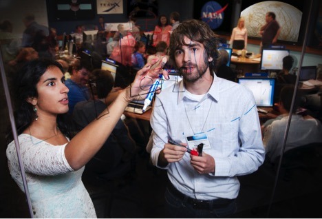
Jacob Earley, left, Frank Jones and his mother, Maria Jones, learned about the effects of gravity on other planets from NASA intern Jessica Hathaway during Homeschool Appreciation Day, which took place May 6 at the Virginia Air & Space Center (VASC) in Hampton, Virginia. Hathaway was one of several volunteers from NASA's Langley Research Center in Hampton who taught homeschooled children and their parents interactive lessons about everything from ultraviolet radiation to engineering satellites to navigating a rover on Mars. Approximately 300 people registered for the event, which has a focus on activities involving science, technology, engineering and math (STEM). The VASC is the official visitor center for NASA Langley.
Joe Atkinson NASA Langley Research Center
The Future of Monitoring Air Quality from Space

TEMPO’s measurements from geostationary orbit (GEO) will create a revolutionary dataset that provides understanding and improves prediction of air quality (AQ) and climate forcing.
The KORUS-AQ airborne science experiment taking to the field in South Korea this spring is part of a long-term, international project to take air quality observations from space to the next level and better inform decisions on how to protect the air we breathe.
Before a new generation of satellite sensors settle into orbit, field missions like KORUS-AQ provide opportunities to test and improve the instruments using simulators that measure above and below aircraft, while helping to infer what people breathe at the surface.
These geostationary instruments will make up a northern hemisphere air quality constellation to analyze their respective regions.Credits: Image Courtesy of Andreas Richter (University of Bremen) and Jhoon Kim (Yonsei University)
“We want to move beyond forecasting air pollution, we want to influence strategies to improve it,” said Jim Crawford, a lead scientist at NASA’s Langley Research Center in Hampton, Virginia. “This is where satellite observations can play an important role.”
Existing low Earth orbit (LEO) instruments have established the benefit of space-based views of air pollution. From space, large areas can be viewed consistently, whereas from the ground only discrete (often single) points can be measured. As Dave Flittner, TEMPO project scientist, explains, a geostationary (GEO) air-quality constellation can accurately track the import and export of air pollution as it is transported by large-scale weather patterns.
TEMPO, or Tropospheric Emissions: Monitoring of Pollution, is one instrument on the road to improving air quality from space. According to Flittner, hardware has recently begun development and TEMPO is on track to be finished no later than fall of 2017, and available for launch on a to be selected commercial communications satellite.
For the first time, TEMPO will make accurate hourly daytime measurements of tropospheric pollutants (specifically ozone, nitrogen dioxide, sulfur dioxide, formaldehyde, and aerosols) with high resolution over the U.S., Canada and Mexico. With help from related international missions, these observations provide a complete picture of pollution sources in the northern hemisphere and how they influence air quality from local to global scales.

These geostationary instruments will make up a northern hemisphere air quality constellation to analyze their respective regions.
Credits: Image Courtesy of Andreas Richter (University of Bremen) and Jhoon Kim (Yonsei University)
About 22,000 miles above the equator, the Korean Aerospace Research Institute’s GEMS (The Geostationary Environmental Monitoring Spectrometer), the European Space Agency’s Sentinel-4/UVN, and NASA’s TEMPO, will maintain their positions in orbit as the Earth rotates, covering a majority of the area from East Asia through greater North America and Europe. Together, these instruments will make up a northern hemisphere air quality constellation.. All three of these instruments analyze the same pollutant concentrations in their respective region, from the morning to evening.
Another critical part of the global air quality constellation are the LEO instruments, such as TROPOMI (a.k.a. Sentinel-5P), which will launch in late 2016 and provide a common reference for the three GEO sensors, allowing for a more accurate assessment of air quality within each region.
Denise Lineberry
NASA Langley Research Center
New Gravity Map Gives Best View Yet Inside Mars
A new map of Mars' gravity made with three NASA spacecraft is the most detailed to date, providing a revealing glimpse into the hidden interior of the Red Planet.
"Gravity maps allow us to see inside a planet, just as a doctor uses an X-ray to see inside a patient," said Antonio Genova of the Massachusetts Institute of Technology (MIT), Cambridge, Massachusetts. "The new gravity map will be helpful for future Mars exploration, because better knowledge of the planet's gravity anomalies helps mission controllers insert spacecraft more precisely into orbit about Mars. Furthermore, the improved resolution of our gravity map will help us understand the still-mysterious formation of specific regions of the planet." Genova, who is affiliated with MIT but is located at NASA's Goddard Space Flight Center in Greenbelt, Maryland, is the lead author of a paper on this research published online March 5 in the journal Icarus.
The improved resolution of the new gravity map suggests a new explanation for how some features formed across the boundary that divides the relatively smooth northern lowlands from heavily cratered southern highlands. Also, the team confirmed that Mars has a liquid outer core of molten rock by analyzing tides in the Martian crust and mantle caused by the gravitational pull of the sun and the two moons of Mars. Finally, by observing how Mars' gravity changed over 11 years – the period of an entire cycle of solar activity -- the team inferred the massive amount of carbon dioxide that freezes out of the atmosphere onto a Martian polar ice cap when it experiences winter. They also observed how that mass moves between the south pole and the north pole with the change of season in each hemisphere.

The map was derived using Doppler and range tracking data collected by NASA's Deep Space Network from three NASA spacecraft in orbit around Mars: Mars Global Surveyor (MGS), Mars Odyssey (ODY), and the Mars Reconnaissance Orbiter (MRO). Like all planets, Mars is lumpy, which causes the gravitational pull felt by spacecraft in orbit around it to change. For example, the pull will be a bit stronger over a mountain, and slightly weaker over a canyon.
Slight differences in Mars' gravity changed the trajectory of the NASA spacecraft orbiting the planet, which altered the signal being sent from the spacecraft to the Deep Space Network. These small fluctuations in the orbital data were used to build a map of the Martian gravity field.

The gravity field was recovered using about 16 years of data that were continuously collected in orbit around Mars. However, orbital changes from uneven gravity are tiny, and other forces that can perturb the motion of the spacecraft had to be carefully accounted for, such as the force of sunlight on the spacecraft's solar panels and drag from the Red Planet's thin upper atmosphere. It took two years of analysis and computer modeling to remove the motion not caused by gravity.
"With this new map, we've been able to see gravity anomalies as small as about 100 kilometers (about 62 miles) across, and we've determined the crustal thickness of Mars with a resolution of around 120 kilometers (almost 75 miles)," said Genova. "The better resolution of the new map helps interpret how the crust of the planet changed over Mars' history in many regions."
For example, an area of lower gravity between Acidalia Planitia and Tempe Terra was interpreted before as a system of buried channels that delivered water and sediments from Mars' southern highlands into the northern lowlands billions of years ago when the Martian climate was wetter than it is today. The new map reveals that this low gravity anomaly is definitely larger and follows the boundary between the highlands and the lowlands. This system of gravity troughs is unlikely to be only due to buried channels because in places the region is elevated above the surrounding plains. The new gravity map shows that some of these features run perpendicular to the local topography slope, against what would have been the natural downhill flow of water.

An alternative explanation is that this anomaly may be a consequence of a flexure or bending of the lithosphere -- the strong, outermost layer of the planet -- due to the formation of the Tharsis region. Tharsis is a volcanic plateau on Mars thousands of miles across with the largest volcanoes in the solar system. As the Tharsis volcanoes grew, the surrounding lithosphere buckled under their immense weight.
The new gravity field also allowed the team to confirm indications from previous gravity solutions that Mars has a liquid outer core of molten rock. The new gravity solution improved the measurement of the Martian tides, which will be used by geophysicists to improve the model of Mars' interior.
Changes in Martian gravity over time have been previously measured using the MGS and ODY missions to monitor the polar ice caps. For the first time, the team used MRO data to continue monitoring their mass. The team has determined that when one hemisphere experiences winter, approximately 3 trillion to 4 trillion tons of carbon dioxide freezes out of the atmosphere onto the northern and southern polar caps, respectively. This is about 12 to 16 percent of the mass of the entire Martian atmosphere. NASA's Viking missions first observed this massive seasonal precipitation of carbon dioxide. The new observation confirms numerical predictions from the Mars Global Reference Atmospheric Model – 2010.
The research was funded by grants from NASA's Mars Reconnaissance Orbiter mission and NASA's Mars Data Analysis Program.
Bill Steigerwald
Testing inflatable heat shields for spacecraft
Engineers at NASA’s Langley Research Center in Hampton, Virginia, are developing inflatable heat shield technology called a Hypersonic Inflatable Aerodynamic Decelerator that could be vacuum packed into a rocket, then expanded in space to allow more cargo or even humans to land on distant planets, like Mars. Here they are testing the packing of a 9-foot diameter donut-shaped test article to simulate what would happen before a space mission.
NASA, Air Force Perform Rescue Operations on Boeing Starliner

NASA astronaut Suni Williams cannonballs off a Boeing CST-100 Starliner test article after NASA engineers and Air Force pararescuemen climbed aboard the spacecraft to simulate rescuing astronauts in the event of an emergency during launch or ascent.
The Starliner is designed for land-based returns, but simulating rescue operations at NASA’s Langley Research Center’s Hydro Impact Basin in Hampton, Virginia, ensures flight crew and ground support are versed in what to do during a contingency scenario.
For more information about rescue and safety operations, see Commercial Crew: Building in Safety from the Ground Up in a Unique Way.
Credit: NASA/David C. Bowman
Nine Notable Facts About the NACA

The National Advisory Committee for Aeronautics (NACA) reached a major milestone in 2015.
On March 3, the agency that in 1958 would dissolve and reform as NASA celebrated its centennial.
NASA Langley, established in 1917 as the Langley Memorial Aeronautical Laboratory, was the NACA's first field center.
During the March 24 talk, Tom Crouch, senior curator of aeronautics; John Anderson, curator of aerodynamics; and Roger Launius, associate director for collections and curatorial affairs discussed the formation of the NACA, the technological breakthroughs it generated, and the evolution of its research and development model.
Here are nine of the more interesting things they shared:
1. Charles Doolittle Walcott, a self-trained scientist and the man whose efforts led to the formation of the NACA, was best known not as an aeronautics expert, but as a paleontologist. "Throughout his long career," Crouch said, "he was really one of the most effective spokesmen for science and technology in the federal government."
2. Walcott was a good friend of aviation pioneer and Wright brothers rival Samuel Pierpont Langley, who was devastated in 1903 when his Aerodrome flying machine twice failed to take flight over the Potomoc River. Langley died in 1906. "One of Charles Doolittle Walcott's aims in life was to resurrect and honor the memory of his old friend Samuel Pierpont Langley," Crouch said — so much so that he once suggested naming all airplanes Langleys. Eventually, Walcott named the Langley Memorial Aeronautical Laboratory after his friend.
3. Prior to World War I, aeronautics was not a high priority for the U.S. government. On a list of the aeronautics appropriations for 14 countries in the period from 1908 to 1913, the United States was dead last with $435,000. That put the U.S. behind Brazil, Chile, Bulgaria, Spain and Greece. Topping the list: Germany, with $28 million.
4. In the late 1920s, Fred Weick, a Langley engineer, developed what became known as the NACA cowling, a type of fairing or cover used to reduce drag on aircraft engines. The cowling also improved engine cooling. In 1929, Weick won the Collier Trophy, U.S. aviation's more prestigious award, for this innovation.
5. By the 1930s, the world had entered a golden era of aeronautics — largely due to the NACA. "The NACA was aeronautical engineering," said Anderson. And some of the most important aeronautical innovations were taking place right here at Langley Research Center. It was during the 1930s that Langley aerodynamicist Eastman Jacobs developed a systematic way of designing an airfoil. That systematic design became known as the NACA airfoil, and aircraft makers worldwide began using it.

In 1934, during a high-speed wind tunnel test at Langley, a researcher named John Stack captured the first ever photograph of a shockwave on an airfoil. Credits: NASA
6. Aeronautics researchers in the 1930s were struggling to determine the cause of a peculiar phenomenon — as an object approached the speed of sound, drag greatly increased and lift drastically reduced. In 1934, a young Langley researcher named John Stack figured out why by photographing a high-speed wind tunnel test of an airfoil. The photo captured the culprit — a shockwave. It was the first time a shockwave had ever been photographed on an airfoil. "This was a dramatic intellectual contribution of the NACA that a lot of people don't really appreciate," said Anderson.
7. The woman who developed the format and style guide for the NACA's technical reports was a physicist from North Dakota named Pearl Young. She came to Langley in 1922, the first professional woman employed at the center, and was appointed Langley's first Chief Technical Editor in 1929. "The technical memorandums … became the model worldwide for how to increase knowledge and make it available to the broadest base of people that can use it," said Launius.
8. The NACA used to host an annual Aircraft Engineering Research Conference at Langley. The conferences were "a who's who of anybody involved in aeronautics in the United States," said Launius. "This interchange of information, of ideas, of concerns, becomes the critical component to fueling the research processes that led to some of the great breakthroughs of the early period before World War II." Among the notable attendees at the 1934 conference were Orville Wright, Charles Lindbergh and Howard Hughes.

A photo taken in Langley's Full Scale Tunnel during the 1934 Aircraft Engineering Research Conference at Langley. Orville Wright, Charles Lindbergh and Howard Hughes were in attendance. Credits: NASA
9. Following World War II, according to Launius, the NACA began to change its "model ever so slightly," making its first forays into public-private partnerships. Perhaps the earliest example of these partnerships was the Bell X-1, a joint project between the NACA, the U.S. Air Force and Bell Aircraft Company. The Bell X-1 became the first manned aircraft to break the sound barrier.
NASA Begins Work to Build a Quieter Supersonic Passenger Jet
The return of supersonic passenger air travel is one step closer to reality with NASA's award of a contract for the preliminary design of a "low boom" flight demonstration aircraft. This is the first in a series of 'X-planes' in NASA's New Aviation Horizons initiative, introduced in the agency's Fiscal Year 2017 budget.
NASA Administrator Charles Bolden announced the award at an event Monday at Ronald Reagan Washington National Airport in Arlington, Virginia.
The return of supersonic passenger travel is one step closer to reality with NASA's award of a contract for the preliminary design of a low boom flight demonstrator aircraft. This is the first in a series of X-planes in NASA's New Aviation Horizons initiative, introduced in the agency’s Fiscal Year 2017 budget.Credits: NASA
"NASA is working hard to make flight cleaner, greener, safer and quieter – all while developing aircraft that travel faster, and building an aviation system that operates more efficiently," said Bolden. "To that end, it's worth noting that it's been almost 70 years since Chuck Yeager broke the sound barrier in the Bell X-1 as part of our predecessor agency's high speed research. Now we're continuing that supersonic X-plane legacy with this preliminary design award for a quieter jet that may break the barrier to accessible, affordable supersonic passenger flight."
This is an artist’s concept of a possible Low Boom Flight Demonstration Quiet Supersonic Transport (QueSST) X-plane design. The award of a preliminary design contract is the first step towards the possible return of supersonic passenger travel – but this time quieter and more affordable.Credits: Lockheed Martin
NASA selected a team led by Lockheed Martin Aeronautics Company of Palmdale, California, to complete a preliminary design for Quiet Supersonic Technology (QueSST). The work will be conducted under a task order against the Basic and Applied Aerospace Research and Technology (BAART) contract at NASA's Langley Research Center in Hampton, Virginia.
After conducting feasibility studies and working to better understand acceptable sound levels across the country, NASA's Commercial Supersonic Technology Project asked industry teams to submit design concepts for a piloted test aircraft that can fly at supersonic speeds, creating a supersonic "heartbeat" – a soft thump rather than the disruptive boom currently associated with supersonic flight.
"Developing, building and flight testing a quiet supersonic X-plane is the next logical step in our path to enabling the industry's decision to open supersonic travel for the flying public," said Jaiwon Shin, associate administrator for NASA's Aeronautics Research Mission.
Lockheed Martin will receive about $20 million over 17 months for QueSST preliminary design work. The Lockheed Martin team includes subcontractors GE Aviation of Cincinnati and Tri Models Inc. of Huntington Beach, California.
The company will develop baseline aircraft requirements and a preliminary aircraft design with specifications, and provide supporting documentation for concept formulation and planning. This documentation would be used to prepare for the detailed design, building and testing of the QueSST jet. Performance of this preliminary design also must undergo analytical and wind tunnel validation.
The detailed design and building of the QueSST aircraft, conducted under the NASA Aeronautics Research Mission Directorate's Integrated Aviation Systems Program, will fall under a future contract competition. In addition to design and building, this Low Boom Flight Demonstration (LBFD) phase of the project also will include validation of community response to the new, quieter supersonic design.
NASA's 10-year New Aviation Horizons initiative has the ambitious goals of reducing fuel use, emissions and noise through innovations in aircraft design, ground operations and the national air transportation system.
The New Aviation Horizons X-planes will typically be about half-scale of a production aircraft and likely are to be piloted. Design-and-build will take several years with aircraft starting their flight campaign around 2020, depending on funding.
For more information about NASA's aeronautics research, visit:
www.nasa.gov/aero

NASA Invites Public to Send Artwork to an Asteroid
NASA is calling all space enthusiasts to send their artistic endeavors on a journey aboard NASA’s Origins, Spectral Interpretation, Resource Identification, Security-Regolith Explorer (OSIRIS-REx) spacecraft. This will be the first U.S. mission to collect a sample of an asteroid and return it to Earth for study.
OSIRIS-REx is scheduled to launch in September and travel to the asteroid Bennu. The #WeTheExplorers campaign invites the public to take part in this mission by expressing, through art, how the mission’s spirit of exploration is reflected in their own lives. Submitted works of art will be saved on a chip on the spacecraft. The spacecraft already carries a chip with more than 442,000 names submitted through the 2014 “Messages to Bennu” campaign.
“The development of the spacecraft and instruments has been a hugely creative process, where ultimately the canvas is the machined metal and composites preparing for launch in September,” said Jason Dworkin, OSIRIS-REx project scientist at NASA’s Goddard Space Flight Center in Greenbelt, Maryland. “It is fitting that this endeavor can inspire the public to express their creativity to be carried by OSIRIS-REx into space.”
A submission may take the form of a sketch, photograph, graphic, poem, song, short video or other creative or artistic expression that reflects what it means to be an explorer. Submissions will be accepted via Twitter and Instagram until March 20. For details on how to include your submission on the mission to Bennu, go to:
http://www.asteroidmission.org/WeTheExplorers
“Space exploration is an inherently creative activity,” said Dante Lauretta, principal investigator for OSIRIS-REx at the University of Arizona, Tucson. “We are inviting the world to join us on this great adventure by placing their art work on the OSIRIS-REx spacecraft, where it will stay in space for millennia.”
The spacecraft will voyage to the near-Earth asteroid Bennu to collect a sample of at least 60 grams (2.1 ounces) and return it to Earth for study. Scientists expect Bennu may hold clues to the origin of the solar system and the source of the water and organic molecules that may have made their way to Earth.
Goddard provides overall mission management, systems engineering and safety and mission assurance for OSIRIS-REx. The University of Arizona, Tucson leads the science team and observation planning and processing. Lockheed Martin Space Systems in Denver is building the spacecraft. OSIRIS-REx is the third mission in NASA's New Frontiers Program. NASA's Marshall Space Flight Center in Huntsville, Alabama, manages New Frontiers for the agency's Science Mission Directorate in Washington.
For more information on OSIRIS-Rex, visit:
http://www.nasa.gov/osiris-rex
Check out what goes on at our Hydro Impact Basin Facility at the NASA Langley Research Center! This steel structure was once our Lunar Landing Research Facility for the Apollo missions.

Commercial Crew Partner Boeing Tests Starliner Spacecraft
Engineers from NASA’s Langley Research Center in Hampton, Virginia, and Boeing dropped a full-scale test article of the company’s CST-100 Starliner into Langley’s 20-foot-deep Hydro Impact Basin. Although the spacecraft is designed to land on land, Boeing is testing the Starliner’s systems in water to ensure astronaut safety in the unlikely event of an emergency during launch or ascent. Testing allows engineers to understand the performance of the spacecraft when it hits the water, how it will right itself and how to handle rescue and recovery operations. The test is part of the qualification phase of testing and evaluation for the Starliner system to ensure it is ready to carry astronauts to and from the International Space Station.
Image Credit: NASA/David C. Bowman
Maybe NASA Astronomer, @michellethaller , can spread some ‘light’ on this topic. She has spent years studying binary star systems!

Isn’t it beautiful two suns setting over the horizon.
See what goes on behind the gates of the NASA Langley Research Center (LaRC)!
There are amazing opportunities at each center. Learn more at: https://intern.nasa.gov
So you want to work at NASA?
An out of this world career or internship might not be as far out of reach as you think. Check out all the ways you can get involved!
If you’re a student…

Our internships are the perfect place to start! We offer paid internships for spring, summer, and fall semesters to U.S. citizens currently attending an accredited university full time. Learn more at: https://intern.nasa.gov
Seriously considering a job in the Federal civil service? Check out the Pathways Internship Program which allows you to do multiple work tours while you finish school: http://nasajobs.nasa.gov/studentopps/employment/iep.htm
If you’re a recent graduate…
If you’re a U.S. citizen who has graduated from an accredited college or university within the past 2 years (or 6 if you have served in the military), then the our Recent Graduates program is just for you. Accepted applicants are placed in a 1 year career development program with the possibility of an additional year, or even granted term or permanent jobs within the agency. Learn more at: http://nasajobs.nasa.gov/studentopps/employment/rgp.htm.
If you’re a professional…

You can search for our job openings any time at USAJobs.com. Create an account, then use the USAJobs resume builder. Want to make sure your resume maximizes your opportunity for a job at NASA? Check out our Applicant Guide: https://applyonline.nasa.gov/applicant_guide.html.
You can then search for our job openings here: https://nasai.usajobs.gov/.
If you want to be an astronaut…

Astronaut candidate applications are accepted every few years- including right now! Get yours in before the current application closes on February 18, 2016.
Do you have a bachelor’s degree in a STEM field and 3 years of related professional experience? You might be eligible. Find out more and apply online at: https://nasai.usajobs.gov/GetJob/ViewDetails/423817000.
Make sure to follow us on Tumblr for your regular dose of space: http://nasa.tumblr.com

We’re Turning 100! Celebrate With Us
That's the way to do it, girl 😂
new hair routine:
take a shower
lie in bed watching khan academy (has to be the physics playlist)
inevitably fall in and out of sleep for 3 hours, sal khans voice telling me the secrets of the universe in my dreams. i now know the exact date and time the universe will end
hair is now fluffy also my IQ is 500 points higher


Scivola silenziosa, accarezzata dalle tenebre e danza solitaria nel cuore del crepuscolo #landscape #land #sad #sun #light #plant #plants #green #leaf #leafs #lea #nature #bloom #flower #bush #natural #petal #petals #stem #color #colour #garden #beautiful #pretty #beauty #colours #growing #planta #plantas #green

Scivola silenziosa, accarezzata dalle tenebre e danza solitaria nel cuore del crepuscolo #landscape #land #sad #sun #light #plant #plants #green #leaf #leafs #lea #nature #bloom #flower #bush #natural #petal #petals #stem #color #colour #garden #beautiful #pretty #beauty #colours #growing #planta #plantas #green

Maggiolini selvatici si scaldano al tepore di raggi impertinenti #Volkswagen #vw #beatle rudere #plant #plants #green #leaf #leafs #lea #nature #bloom #flower #bush #natural #petal #petals #stem #color #colour #garden #beautiful #pretty #beauty #colours #growing #planta #plantas #green
Vote!
*Which btw is a site with scientific topics especially for young children
Thanks!
*Which btw is a site with scientific topics especially for young children
Thanks!
It`s gonna be Moon Soon season in India!! @neysastudies

The last time any country put boots or, rather, little metal feet, on the Moon was in 2013, when China landed its Yutu rover there. Before that, you’d have to look back to the 1970s to find anything built by Earthlings that camped out on the surface of the Moon.
But in 2018, India says it will be ready to join the ranks of the moon lander. The Indian Space Research Organisation (ISRO) is getting ready to land its very first lunar rover by the end of March 2018, as part of its Chandrayaan-2 mission.
Continue Reading.
STEM students who don't refer to their living areas as "stem cells" are wasting an opportunity and need to switch majors immediately.
Anybody here good at physics an willing to answer any questions, I'm desperate 😭
I think i'm cooked for my final ngl

As a student of color in STEM, that scene perfectly describes what I think about everyday. Here’s a quick list of everything that I am doing:
I have a 3.71 GPA
I volunteer 10+ hours every week
I am a part-time researcher on campus (at some point I’ll make a post about my research)
I am helping to develop a CubeSat as a part of an team of undergraduate students
and I am developing my own educational outreach student organization to bring more students of color into STEM
and you know what?
I probably still won’t get as far as rich, white students who haven’t worked nearly as hard as I have. I grew up just above the poverty line, so I don’t have the connections that those students have, it sets me apart, and it sets me behind.
The students who have those connections were able to get internships and research positions in high school, without even trying. Meanwhile, I got my first research position half of the way through my second year of college because I worked my ass off during my first year and the first half of this school year. My story is in no way unique. This is the experience of thousands of students of color around the country. We have to work so hard to get half as far as our white counterparts, and it’s just bullshit.