
30. she|her|hers. montrose, colorado, or the side of the state no one knows about. originally from washington dc social worker, obsessed with my dog, mountains....
219 posts
Latest Posts by backwoodsnbrush - Page 7


Narrow Gauge Rail in the San Juan Mountains. Photo by Noah Larimer.
Home!!


“Million Dollar Highway” | San Juan Mountain Range, Colorado
Silverton, Colorado - August 1981 by Larry Syverson Via Flickr: I drove Colorado’s ‘million dollar highway’ from Durango to Silverson and Quary in August 1981. Being a flat-lander, the highway was very scary. A couple of times I wanted to turn around and go back. Fortunately, I didn’t. Silverton, Colorado in August 1981. It was worth the drive up!


Ouray Co. 1/17/2017
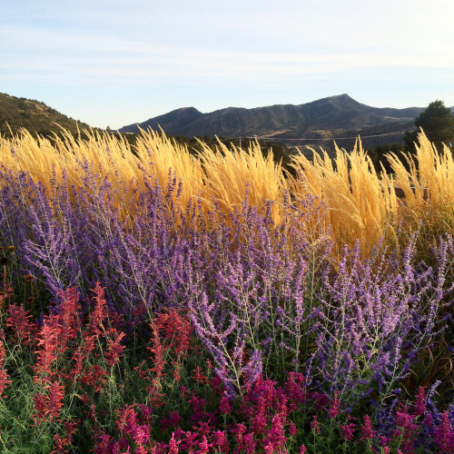

Wee Wet Wild Flower
Camelback Wilderness Study Area
[05|30|16]
This one is a bit of a mystery. This is why I need to write my blog right after each hike! I mean I know that Kelli and I did not make it to the trailhead. I’m pretty sure we did a lot of driving in the desert, where all the roads started looking the same, and at some point we decided to just get out and just start hiking on one of the dirt roads. There were a bunch of 4-wheelers out there. It was a bunch of BLM land. And with all my googling I cannot for the life of me find out what hike we had intended to do.
My guess is this Roubideaux Canyon hike, but apparently you get to it through Delta county, and for a fact I remember we started off west of town on spring creek road and didn’t have to drive too far before we got there.
Descriptive article about the hike but I can’t seem to find trailhead directions
Interesting article about the area switching from wilderness study area status to BLM status
But then I also am really thinking that it might have been the Montrose part of the Tabeguache trail, or that that was at least what we were aiming for.
I don’t recall the actual hike being overly exciting. Maybe I was worried I just didn’t know where we were. I remember arguing with Kelli about the town we could see--if it was Montrose or Olathe. Pretty sure we decided it was Olathe. I remember not being able to wrap my head around that lol. Nice views of the Black Canyon. Lots of cacti in bloom! I remember finding it amazing that more explorable wilderness was again, just 15 minutes away from Montrose! Kelli and I talked about maybe camping there at some point, but that never happened.


Weehawken Trail
[05|29|2016]
We definitely didn’t finish this trail. We wouldn’t have been able to finish this trail in generally because of it’s difficulty and our lack of preparedness for that. Secondly, it started to rain, which I guess was a bummer, but I recall us being 100% blown away by the difficulty. man0man. I spoke to a co-worker after the hike, and he said “Ohhh. That one. My wife re-named that trail the “We-Walkin” Trail!” Danggg. The Denver Post’s article on the hike does a great job of describing the hike (as I think we only got about a mile--which according to that article is where 1000 ft of the total 2200 elevation gain. Here is another shorter post that may be helpful in terms of directions/data). This wouldn’t be our last time on the trail, and it wouldn’t be our last time on the trail in which we didn’t reach our destination. This is definitely one to bag for...June? It’s hands down going to be one of those hikes that you’ll enjoy more if in better shape. It’s easy to get to which is saying a lot coming from me. ANYWAY we had to end our hike short due to rain--I can’t say it was unwelcomed. As we were not in shape.


sick day
decided to take a sick day today. woke up feeling pretty nauseous and then just wasn’t feeling attitudably appropriate to have 7 individual therapy sessions. so i called in. it was a good decision. i really honestly didn’t want to do shit. i was going to just sleep all day. but my dog wasn’t going to let me!
we decided to head out to cerro summit cerro summit has been one of our winter snowshoe staples so I was really unsure as to what the conditions were.
they were muddy! really muddy. we went along the open meadow trail and glade (my dog) was not really having it so we turned around. instead, we just ran along the road! it was super beautiful. great views. nice and dry despite two or three patches of snow (which glade absolutely loved). we didn’t really go too far on the road, probably about a mile and a half, and then we went back. it’s definitely somewhere i’d like to return and go farther. i may just want to check the legality of it though. there were no no trespassing signs except for the land on the left and right...i don’t know though, always good to be sure.


Gunnison Gorge, Colorado

Blue Mesa Reservoir by Joel Colorado

Welcome to Ophir. Population 163. Elevation 9600. 55 Kids. 30+ Dogs. 15+ Cats. Countless Avalanches.

Beautiful Ophir Valley, Colorado
An old video, and lamentably low rez, but beautiful nonetheless.
I love this part of the state, although I rarely head that way during the winter.

Ophir, Colorado Rio Grande Southern Railroad train station, 1940.
Exploring the Colorado Rockies
Westcliffe, Colorado is located about an hour and a half southwest of Colorado Springs in the Wet Mountain Valley. Surrounded on each side by the Sangre de Cristo mountain range to the west and the Wet Mountains to the east, this small community has a beautiful backdrop and plenty of sights to see.
Keep reading

Misty Morning, Crested Butte

Layers of Colorado
More of our amazing world

Sottsass Associati, Wolf House, Ridgeway, Colorado, 1987-1989

Red Mountains, from Corkscrew Gulch

Up on Last Dollar Road, Coloradocolor

SHELTER. @maddiebrenneman and @ngkelley chasing trout and dreams in Southern Colorado. #TrustTheWild | #LiveTheMountainLife Photo: @ngkelley by western_rise

Denver and Rio Grande Western Railroad narrow gauge train #The Silverton” in the Animas River Canyon, Colorado, 1959.

Big enough to be overwhelming, still intimate enough to feel the pulse of time, Black Canyon of the Gunnison exposes you to some of the steepest cliffs, oldest rock and craggiest spires in North America. This western Colorado landmark was sculpted by the Gunnison River and the forces of weather over 2 million years. Photo of a snowy and fog-filled canyon by Judd Clark, National Park Service.
Silverton, Colorado - August 1981 by Larry Syverson Via Flickr: I drove Colorado’s ‘million dollar highway’ from Durango to Silverson and Quary in August 1981. Being a flat-lander, the highway was very scary. A couple of times I wanted to turn around and go back. Fortunately, I didn’t. Silverton, Colorado in August 1981. It was worth the drive up!
“Million Dollar Highway” | San Juan Mountain Range, Colorado